Friday, January 29, 2021

Hannah Fentress

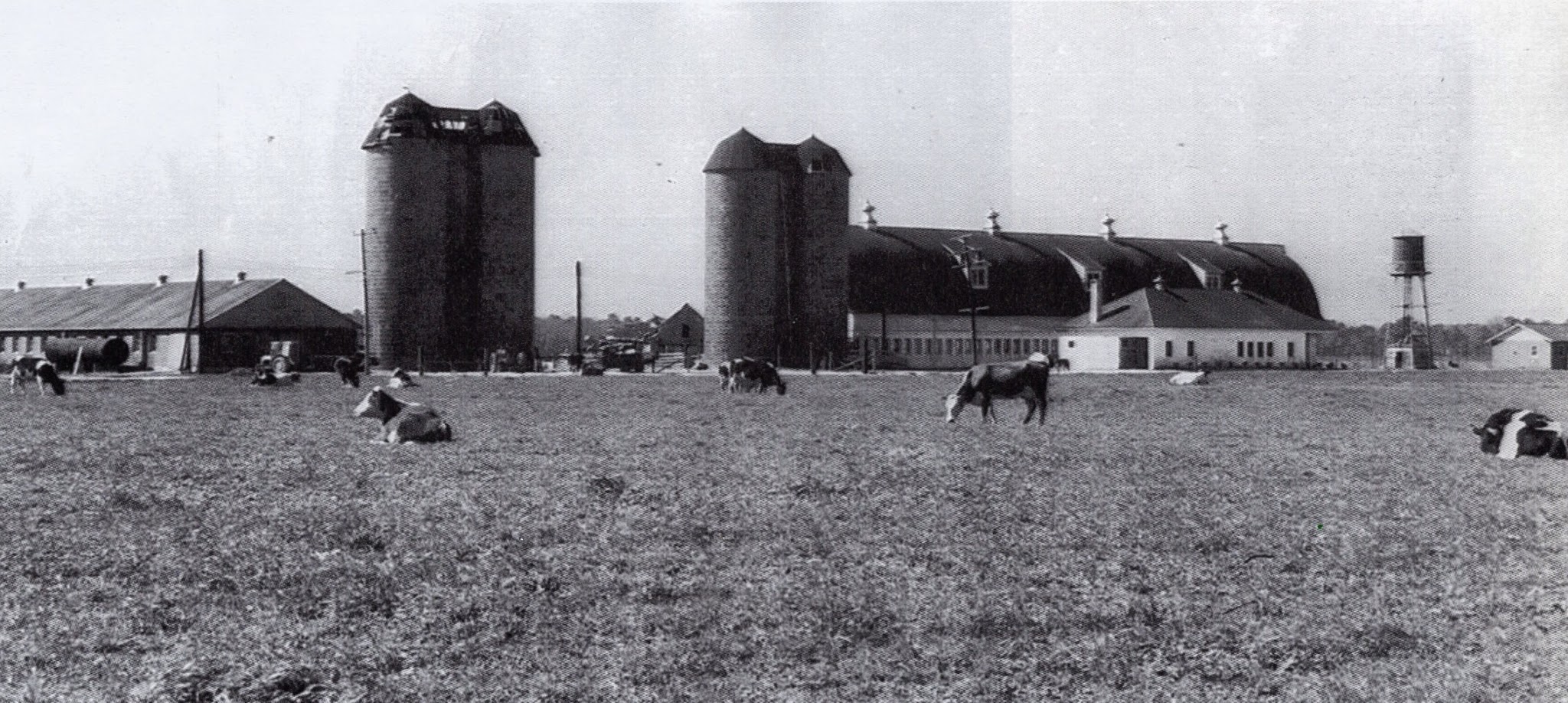
 I am happy to count Hannah Fentress as one of my neighbors.  Hannah's husband Joseph moved to Woodstock in 1952, having purchased the house and property that is today 604-612 Woodstock Road.  Hannah and Joseph married after the death of his first wife, Emily (d. 1965) and Hannah remained a Woodstock resident until she died in 2001 at the age of 91.

If you think it odd that I consider a woman who died 10 years before I moved here a neighbor, then I beg your favor in this matter.  Woodstock is defined not only by the present, but also the past; and there are neighbors still living here that remember Hannah.  We both traveled along the same road, and I wonder if someday my road will lead to where she is.

I don't know why Hannah wrote this short biography less than two years before her death in 2001, but it fills me with awe to think that I know neighbors who knew Hannah -- who recalls leaving her birthplace in a covered wagon.

Thanks to Mark Robison who sent me this document and photo back in 2013.


History of my Life

I was born in Portland, Oregon in 1909, on December 13. Just think if I had been born nine years sooner I would have lived in 1900 and 2000.

We left Portland in 1911 in a covered wagon. Not many people had cars then. We went to Illinois by train in 1915. My Mother's people lived there. Her sister took us someplace where we sat on a bank. I was five years old and I thought that it was the end of the world. The fifth child was born there. We went to Charlotte, N.C. in 1920 to see my Father's family. In 1920 my brother was born. We were living at Camp Green. We had a well there and the soldiers would stop and get a drink of water. There was a persimmon tree by. They were nice and rosy cheeks but by no means ripe. They looked tempting. I don't know how many soldiers tried them but some did. They got a very bitter mouthful as they are supposed to be soft and brown.

We came to Ocean View, Norfolk. We purchased property and put up a tent my Father built sides to, and finally had nice house. We moved several times but finally settled in Glenrock where we built and I married in 1929.

I went to work for the City Manager of Norfolk as a cook. They found out that I was going to get married and asked us to go to their Summer House in Accomack County.

We bought 100 chicks right away. The first night the rats got half of them. The next night they got the rest. That was the end of our chicken business. They had a yacht and paid my husband to take them out in it. They had oyster floats where the crabs shed their shells. They had clams and fishes, also. People were not there always. We had the place to ourselves especially in winter. They had a Methodist Church. We picked strawberries in the Spring when we came back to Norfolk.

I went to work at the Navy Yard. I had a little machine that I set up my own work. When they were laying the women off, there were eight left. I had a piece of material the size of a thimble. I made each of us a thimble and the boss, too. After that I went to work in a clothing plant in the coat department. Each piece of the coat was made separately and then put together. 

When that closed down I took in children and kept them until I was past seventy years old and settled down to be a housewife.

I was baptized at fourteen years and have been going to the same Church for seventy-one years. Praise the Lord!

At the time that I was taking care of children I was getting married again. I had four children from the same family that I had kept over four years. My fiance told their Mother that we would take them if we could adopt them. She took them back. The youngest; Debbie, kept crying for me. Her Mother said we could adopt her. She is now forty-two years old and has helped me a lot, although she has been married eight years. They haven't any children, yet. I will be ninety years old in December. Praise the Lord that I can still keep house and go to Church each Sunday.

Thursday, June 5, 2014

Thomson's Corner & Coleman Farm

In 2003 a group from Oaklette United Methodist Church published a book entitled Indian River: From Farmland to Suburbs 1700-1960. They gathered dozens of stories and hundreds of photos from members and neighbors to produce a detailed history of the Oaklette/Norfolk Highlands area. Unfortunately the book is out of print and hard to come by these days, so hopefully a parishioner will see fit to donate a copy to the Virginia Beach Public Library.


There are a couple of photos in that book that might be of interest to Woodstock residents, and the good people of Oaklette UMC have granted me permission to share them with you:


THOMSON'S CORNER


This photo is originally credited to Marjorie Wolters.
Reprinted here by permission of Oaklette UMC.


Look carefully and you will see handwriting in the top-right corner that says "Thomson's store 1902". Thomson's Corner, known more recently as Barrett's Corner, is the intersection of Providence and Indian River Roads. The structure at the center of the photo is Thomson's store, which was located on the property that is now Lidl's northeast parking lot. To the right, Indian River Road extends northwest toward Norfolk Highlands, Oaklette and Berkeley; and to the left, [Old] Providence Road extends southwest toward South Norfolk (though in 1902 Providence Road was referred to as Kempsville Road or "the road from Kempsville to Providence Church.").

While the photo is clearly from an age gone by, the 1902 date is in question. Robert Thomson was born in 1881 in Lanarkshire, Scotland, and emigrated to the U.S. in 1904. In 1909 he purchased several acres of land between Indian River and [Old] Providence roads (from the intersection west to the old bank property) and set up shop. It is certainly possible that the photo is from 1902 but the structure was referred to as "Thomson's store" when the photo was labeled and cataloged at a later time. It is also possible that the photo was taken at some point between 1909 and 1936.

Robert Thomson died in October of 1936. In June of 1946 the land was purchased by Joseph A. Barrett, Sr. The area is still referred to as Barrett's Corner today.


COLEMAN FARM


This photo is originally credited to Bonnie P. Moore.
It is reprinted here by permission of Oaklette UMC.


Immediately behind Thomson's store, a little further down Providence Road and about 40 years later, is the G.C. Coleman Farm (now College Park). The barn pictured here survived until recently, having served for many years as the meeting hall of Trinity Tabernacle Church (aka "The Barn"). Today that land hosts the 900 Aquoa apartment complex.

This photo is dated ca. 1945; and based on the angles of the buildings in view, I will guess that the photo was taken somewhere near the Dunkin Donuts entrance on Old Providence Road, facing south. Providence Road was re-routed ca. 1970 to the other side of the barn as Coleman Farm was developed into the College Park subdivision.

A special "thank you" to Frank Nuckols Jr., who let me borrow his copy of the book.


Thursday, December 26, 2013

Jesse J. Parkerson

While Pheby Richards holds the title of Woodstock's first resident, it was Jesse J. Parkerson who transitioned much of Woodstock from woodland to neighborhood during World War II. From the mid-nineteenth century until 1940, most of the property east of Woodstock Road was just that -- wood stock; 150 acres of timberland [1]. Raymond DeFrees purchased this land from his brother-in-law Emmet Don Sheets in 1929, but lost the property to foreclosure during the economic turmoil of the 1930's [2]. Jesse J. Parkerson, a real-estate investor and president of the Merchants and Planters bank purchased the property out of foreclosure. He parceled it up into 4 and 8 acre lots which were then sold off over the next 8 years [3].


Princess Anne County Map Book 12 page 45. At this time, Woodstock Road is known simply as "Public Road" and Walker Road is "Private Road".


Parkerson called upon Burt Hunter, a tenant farmer who had been living in Woodstock for nearly 10 years, to meet with potential buyers and show property boundaries. In trade for his services, Mr. Parkerson conveyed a 1 acre plot of land at the corner of Woodstock and Walker Road to Burt and his wife Della.

The following is an excerpt from the 1959 book, The History of Lower Tidewater Virginia:

JESSE J. PARKERSON—Since 1929, Jesse J. Parkerson has been president of the Merchants and Planters Bank of Norfolk, and his experience in his profession dates from the early years of the century. He joined the staff of the bank in 1902 and has played a conspicuous part in its growth. Not only as a banker but as a progressive citizen and promoter of civic causes, he has proved his value to the area.


Born July 23, 1884, in Berkley, Virginia, now a part of the city of Norfolk, he is a son of the late W. T. J. and Cherry (Martin) Parkerson. After attending public and private schools and a business college, he began his career in Berkley as a runner for the Merchants and Planters Bank on January 2, 1902. Advancing through the positions of bookkeeper and teller, he was made cashier on December 31, 1909, and was elected president on January 16, 1929.


The Merchants and Planters Bank was the first financial institution to be established in that part of the city which lies across the eastern branch of the Elizabeth River. It opened its doors April 1, 1900. Founded through the efforts of Alvah H. Martin, Sr., and other progressive citizens, it began its existence with a capital of thirty thousand dollars. Foster Black was its first president, and he was succeeded by Alvah H. Martin, who saw the bank's capital increased to fifty thousand dollars. Following the death of Mr. Martin on July 5, 1918, Colonel S. L. Slover became its executive head. During his tenure of office, two branches were opened: the Campostella Branch, at Campostella Road and Springfield Avenue in 1924, and the South Norfolk Branch, Twenty-second and Liberty Avenue, in 1927.


Active in other business connections as well, Mr. Parkerson is treasurer and a director of the Chesapeake Building Association, and a director of the Security Insurance Agency, Inc. He is president and director of the South Norfolk Bridge Commission, a director of the Norfolk Chamber of Commerce, and a member of the Virginia State Chamber of Commerce, and as a bank executive, belongs to the Virginia Bankers Association and the American Bankers Association. In his own city he is a member of the Norfolk Executives Club, the Norfolk Yacht and Country Club, and Doric Lodge No. 44, Ancient Free and Accepted Masons. In Masonry he is a member of the higher bodies including the Ionic Chapter of Royal Arch Masons. In civic and philanthropic fields, he serves on the board of directors of the Central Young Men's Christian Association, as treasurer of the Norfolk area of the Virginia Society for Crippled Children, as a member of the lay board of the DePaul Hospital, and of the Pension Bureau of the city of Norfolk. He has been active in the Norfolk Community Chest fund campaigns; and during the World War II period, did outstanding work for the Norfolk War Finance Committee on behalf of the United States Treasury Department. A communicant of the Memorial Methodist Church of Berkley, he formerly served on its board of stewards and as treasurer.


On October 31, 1906, Jesse J. Parkerson married Emma Clark Markham of Elizabeth City, North Carolina, daughter of the late James C. and Emiline (Purdy) Markham, both of whom were born in North Carolina. Mr. and Mrs. Parkerson are the parents of one daughter, Lois, a graduate of Randolph-Macon College at Lynchburg, Virginia. She married William E. Warren of Norfolk. Mr. Warren is vice president and director of the Merchants and Planters Bank of Norfolk, and is in charge of its Lafayette Boulevard Branch. Mr. and Mrs. Warren are the parents of one daughter, Ann Parkerson Warren. Mr. and Mrs. Parkerson make their home at 944 Larchmont Crescent, Norfolk. [4]

-=-

Jesse J. Parkerson died November 21, 1959, at the age of 75.


I was discussing the new Jordan Bridge with my wife. We were looking for pictures when I came across this one and thought, "Hey! I know that guy" -- in a historical figure sense, of course. [5]


ENDNOTES:

[1] Woodstock's development can be broken down into 3 regions: north Woodstock, bordered by Walker Road, I-64 and the river was the first plot of Woodstock proper to have a residence. West Woodstock was not part of Edward Herbert's Woodstock, but was grafted in over time. East Woodstock, spoken of here, originally included the land between Woodstock Road and present day Rodney Lane, if Rodney Lane were extended from Providence Road to the river.
[2] The DeFrees family would keep their primary residence through the 1950's -- a dairy farm located at the historic Francis Land house on present-day Virginia Beach Blvd.
[3] Lot 17 was the exception, weighing in at about 43 acres. Frederick L. Hood purchased this land from Mr. Parkerson in May, 1942. The land was later purchased by Silas Harrison, brother of Walter Harrison (who lived on what is now the Woodstock Cove subdivision from 1934-1951). Silas' widow Mildred Harrison sold the land to developers in the mid-1960's, and it is now part of the Avalon Terrace subdivision.
[4] Wichard, Rogers Dey; History of Lower Tidewater Virginia, Vol. 3, p. 22 Lewis Historical Publishing Co. Inc., New York, NY 1959
[5] Photo source: http://www.cityofchesapeake.net/Assets/documents/departments/public_works/jordan-bridge-assessment/2008-08-19-Jordan-Bridge-photo-gallery.ppt?


Thursday, August 22, 2013

Burt and Della Hunter

Deed records form the backbone for much of the research found in these posts. But there is so much that a deed does not say: were these people good neighbors, well liked in the community? Were the grantors friends of the grantees, or family; or did the transaction take place between anonymous persons who never met?

I really enjoy finding connections that extend beyond mere real-estate transactions. I was gratified to learn that the Olivers, Harrisons and Steeles were not merely neighbors, but family [1]. I received similar good news when I met recently with sisters Debbie Yancey and Ruth Barrett to look through their old photo albums. Debbie and Ruth are daughters of Perry and Helen Kight and former Walker Road residents. Debbie contacted me after reading this blog to let me know that Burt and Della Hunter were her grandparents.

My first introduction to Burt and Della, beyond the 1941 deed for their property on the south side of Walker Road, was from my interview with Mary Anne Harrison Smith. Della was the neighborhood gossip who kept Mary Oliver from her chores; Burt was the Jack-Sprat-ly fellow who was falsely accused of leaving Della's undergarments on the clothes line (they had actually been pranked by the Harrison children). Thanks to Debbie and Ruth, I learned much more about Burt and Della; and they passed along some photos of Woodstock from the 1930's to the 1970's that I am pleased to share with you now.


In the 1930's Burt and Della Hunter were tenant farmers on the Perdue (later Walker) farm along what is now Sterling Road. When Jesse Parkerson purchased the 150 acres of woodland along the east side of Woodstock Road in 1940, he enlisted Burt Hunter to show the 4 and 8 acre parcels to potential buyers; identifying plots and pointing out property boundaries. In exchange for his services, Mr. Parkerson conveyed a 1 acre plot along the south side of Walker Road to Burt. As a result, Burt and Della became the first homeowners on the east side of Woodstock Road.


This house, located in what is now the front yard of 501 Sterling Road, was first made known to me as the Perdue home from the 1920's. Burt and Della occupied this home as tenants of the "Walker house" (as it came to be known) in the 1930's. That's Burt and Della's daughter, Helen Kight. That's the river on the other side of the house.


Della, tending chickens on the Walker farm, pre-1941. She is probably standing about where 512 Sterling Road is now, and we are looking southwest, toward where Sterling Court is today.


That barn is behind what is now 524 Sterling Road, in the east-bound lane of I-64. Burt and Della were the last tenants to farm the land along Sterling Road. Subsequent owners kept cows and horses until the mid-1960's.


The Hunters' new home after 1941, at the corner of Woodstock and Walker Roads. The house was of modest rural construction, with some of the roof joists still covered in tree bark. Bathroom facilities were outside. The house was torn down in the mid-1970's, and today that plot of ground is 5881 Walker Road.

I date this photo prior to 1945 because the Jimmy Steele house (now 568 Woodstock Road) doesn't appear to have been built yet. It should be on the other side of the car. The farm beyond is the Oliver farm at this time, or the 500 block of Woodstock Road today.


This is Helen "Snookie" Kight (elder sister of Debbie and Ruth, daughter of Perry and Helen Kight). If we take a guess at her age (I'll say 3?) then this picture is ca. 1946. That is the Jimmy Steele house to the right, and the former Oliver farm beyond. The Olivers (in their late-60's by this time) sold their farm the year before and bought Jimmy Steele's house.


Snookie again, with Woodstock Road behind her and the former Hastings farm on the other side of the road (E.V. Williams Construction owned it at the time this picture was taken; ca. 1958). During the E.V. Williams years, this property was used as a borrow pit and a trash dump. Today the land in view here is 613 Woodstock Road, Woodstock Cove Park, and a lake.


Walker Road, ca. 1970. Note the vehicle travelling on I-64 in the distance. The Kight house is on the right, occupying the eastern half of the Hunter property. The Kight house was demolished in 2011 and 4 brand new homes occupy that land today.


Neighbors: Mary and John Oliver, with John surrounded by his grandchildren, Mary Craddock (on his left) Joan Craddock (on his right) and an unidentified little one in front of him; The Olivers' daughter Elsie Craddock is front row left, with Burt and Della Hunter on the right. That structure in the background is the garage for the Jimmy Steele house, which still faces Walker road today.


--

ENDNOTES:[1] I may be making references that newer readers are not familiar with. For a good overview of Woodstock's history, including notable names and dates, see my PowerPoint presentation.


Thursday, July 11, 2013

Before There Was Kemps Landing School

Today I found the Sargeant Memorial Room at the Norfolk Public Library. If you read any books on local history, there is a very good chance that several of the photos will have "Courtesy of the Sargeant Memorial Collection" noted somewhere nearby. I asked about their Princess Anne County photo collection, and the guy at the desk pulled four file folders out of a drawer and handed them to me! I spent the next 30 minutes or so sifting through old photos.

One set of photos caught my eye immediately, because they answered a nagging question that has occupied my mind since my interview with Mary Ann Harrison Smith. She said she attended Kempsville Elementary during her grammar school years (1942-) and that the building had "real pretty white columns in front". I attended Kempsville Elementary in 1978 & 1979, and there were no "real pretty white columns!" I also knew that my Kempsville Elementary only dated back to the 1960's, so she couldn't be referring to that building. I knew Kemps Landing School was older, but Kemps Landing doesn't have real pretty white columns either.

The Virginia Beach Public Schools website has a short history of the old Kempsville Elementary and it seems to indicate that the building that eventually came to be known as Kemps Landing, built in 1941, was the original Kempsville Elementary. But what about the pretty white columns? Mary Ann did say that her old school was torn down; so did they tear down a previous school with white columns when they built Kemps Landing? But if that is the case, it would have been torn down before Mary Ann was old enough to attend.

This is when the Sargeant Memorial Collection clarified everything for me:

Photo courtesy of the Sargeant Memorial Collection

There is an inscription on the back of this photo, "Kempsville Grammar and High School; 10-7-31". YES! There are COLUMNS! In fact, there are two buildings here, side by side, and they both have columns. Which one is the grammar school? Which one is the high school? The photo doesn't specify.

Photo courtesy of the Sargeant Memorial Collection

This is a photo of the building on the far left in the first photo. This photo is inscribed, "Kempsville Grammar and High; 10-9-31". Not much clarification there, but I did notice something: take careful note of the windows on the left...

Photo courtesy of the Sargeant Memorial Collection

Here is the building we are all familiar with, because it still exists today. The photo is inscribed, "Kempsville High School; 5-14-42". My generation knows it as Kemps Landing (not the magnet school; before the magnet school); but whatever you call it, there it is. Now, please note the building to the right of the new high school: see the windows? It looks like they did not tear down the old schools when they built the new one.

This photo has been floating around the Internet for a couple of years now, but I saw it most recently in a Facebook post:

It is a postcard of Kempsville High School, but there is no date. I was always under the impression that the two buildings to the right were the old jail and a municipal building -- but it is crystal clear now that all three buildings are school buildings. The two buildings on the right are the buildings in the photographs above.

With just a little more research, I found this photo on the Virginia Beach Public Library website:

Now we know which building was the grammar school and which was the high school! The last graduating class was in 1941, and the doors opened at the new high school later that year.

For the record, the grammar school is the oldest building here, constructed in 1910. Both the grammar school and the old high school would be demolished prior to 1953 to make room for a one-story addition to the new building. That addition survived until very recently, when it was torn down to accommodate the re-routing of Princess Anne Road.

While on the subject of additions, I noticed one more thing while studying these photos. Those of us who have lived in Kempsville for any length of time know about the one-story addition to the Kempsville High/Kemps Landing building; but these photos show that was not the first addition that was made:

The wall that faces the grammar school is the northernmost edge of the building in this 1942 photo.

By the time this picture was taken (before 1953) a new wing has appeared on the northwest corner of the building. That addition is still there.


Tuesday, July 9, 2013

Pheby Richards and the Craney Island Lighthouse

If you've watched my Woodstock History PowerPoint presentation, then you are already familiar with Pheby and Elisha Richards. Pheby's name is on the 1878 deed for Woodstock Farm, so the Richards are probably the first family to call Woodstock home. 1878-79 was a time of great transition for the Richards family, which may explain why Pheby ended up selling the farm just a few years later. Despite their abbreviated tenure, Elisha and Pheby are part of the Woodstock story -- a story that recently became a little more personal.

During a routine Googling session I found Pheby and Elisha Richards names on U.S. Treasury Department payroll documents from 1877 and 1879. They were listed as keepers of the Craney Island Light at the entrance to the Elizabeth River. I was astonished that someone at Google took the time to digitize the U.S. Treasury Department payrolls for 1877 and 1879, and make them available online! Those particular documents seem almost random in terms of historical significance, but they provided a fascinating historical connection between Woodstock and the larger Hampton Roads history.I started an e-mail campaign to locate any documentation that might be available for the Craney Island Light. Several Virginia and North Carolina lighthouses have survived to this day; but unfortunately, Craney Island is not one of them. Probably for this reason much of the documentation from that period has been lost to history, save one item: a hand-written letter from Pheby Richards to the Secretary of the Navy.


Photocopy courtesy of the National Archives


Craney Island LH

July 22nd 1879

Honorable Wm Sherman
Secretary of the Navy
Sir: I have been assistant keeper at this station for nearly six years my husband Elisha Richards being principal. But it has now pleased God to remove him by the hand of death. I still wish to retain my position here and I have a son (W.B. Wilder by name) 26 years old who is quite capable and with your permission will come to my assistance and fill the place now vacant. There are many applications already in & I come to you to say that if I can retain my position here it will be of great service to me and to ask you to favor me in this matter. This station is near Norfolk and not far from shore and for many years past (even before the war) one of the keepers has been a female. The next station to this also has a lady assistant.Very respectfully your obedient servant,
P.D. Richards


As lightkeepers at Craney Island from 1873-1879, Elisha and Pheby would have maintained a residence there. Lighthouse appointments were generally restricted to persons between the ages of 18 and 50; but by 1878, Elisha and Pheby were both well into their 50's, with Elisha 4 years her senior (this might also explain why she mentions her son-in-law's age). They may have been looking forward to their next stage in life when they purchased farm land in Princess Anne county; however, plans changed in July, 1879 when Elisha died suddenly of a probable stroke.

As if to compound the tragedy of the sudden loss of her husband, Pheby's request to keep her position at the lighthouse would arrive just a few days too late. Written on July 22nd, it was received by the lighthouse board on July 26th; on July 23rd, the board nominated Robert B. More as acting lightkeeper at Craney Island, with Marshall Sand taking over as acting assistant keeper a few months later.

Pheby sold Woodstock Farm in 1882, at a 10% loss. She lived with her daughter Fannie and son-in-law James W. Bacchus in Norfolk for many years after, and by 1910 (just before her death) she was living in Portsmouth with another daughter Ella and son-in-law William Wilder (the one mentioned in the letter).

In the years that followed, The Craney Island Light fell victim to severe structural decline. In 1884 the 25 year old square structure was replaced with an entirely new octagonal structure. This second lighthouse is the one usually represented in pictures of the Craney Island Light. That structure was replaced in 1936 by an automated beacon. Today, only a signal bouy marks the spot once occupied by the Craney Island Light.


NOTES

R.B. More is listed as the keeper of the Cape Charles lighthouse in the same 1877 payroll document, but he is not on the 1879 payroll, probably because he retired by this time. An Infantry Captain in the Civil War, More was 65 years old when he (temporarily) took over duties at Craney Island.

The "next station" that Mrs. Richards refers to in her letter is probably the Lambert's Point lighthouse, staffed by William L. Clegg and Mrs. J. V. Clegg.

There is some incongruity in Mrs. Richards addressing a "Wm Sherman" as Secretary of the Navy. Richard W. Thompson was Secretary of the Navy from 1877-1880. However, the national network of lighthouses was under the oversight of the Department of the Treasury, not the Navy. John Sherman was Treasury Secretary from 1877-1881. John's brother was William Tecumseh Sherman, the famous Union general during the Civil War.

This research thread has led to one correction in the PowerPoint presentation: a couple of family record references state that Elisha Richards died in 1878. However, the U.S. Treasury Department records indicate that he remained on the payroll at least through the end of 1878, and he is on the 1879 roster. It seems unlikely that the lighthouse board would wait an entire year to fill the vacancy, and it also seems unlikely that Pheby would wait a year to defend her position to the lighthouse board. 1879 seems like the more likely year of Elisha Richard's death.


Wednesday, July 3, 2013

Woodstock Road

If Woodstock Road isn't the oldest residential street in Kempsville, it certainly rates in the oldest 1% of residential streets in Kempsville; and possibly in all of Virginia Beach. I am making a distinction here between residential streets (roads that serve specific neighborhoods; Lord Dunmore Drive, Edwin Drive, Indian Lakes Blvd., etc.) and main roads (roads that interconnect municipalities like Norfolk, Kempsville or Great Bridge and are generally lined with businesses; Kempsville Road, Princess Anne Road, Indian River Road, etc.). I will grant that in Princess Anne County's rural years, farms lined the main roads; and even today Kempsville Road is lined with houses. But with the proliferation of suburban residential development beginning after World War II, and really gaining steam in the 1970's, Woodstock's 19th century origins set it apart from other Kempsville neighborhoods like Fairfield, Larkspur and Indian Lakes.


The Evidence


Plat of Woodstock, 1877. Note the road along the eastern border. This is not the present day Woodstock Road; in fact, this road no longer exists. The present day Woodstock Road is not depicted on this plat, which means it was probably constructed after 1877.


The first mention of the right-of-way that we now refer to as Woodstock Road occurs in the deed of sale between Samuel Kimberly and Pheby Richards in 1878. Mrs. Richards purchased a 65 acre riverfront plot from Kimberly; from present-day Walker Road north to the river, and from I-64 west to the creek. Her land was separated from the main road (Providence Road) by the rest of Kimberly's land to the southeast and the Whitehurst farm to the southwest. The construction of a new road between these two properties would be necessary to allow Mrs. Richards access to her purchase. The deed of sale grants "the said Kimberly ... the right of use of the road or lane running through the land of said Pheby D. Richards to the creek or river, and the said Samuel Kimberly agrees that the said P. D. Richards shall have the right of way to the main road 40 feet wide." (Princess Anne County deed book 54 page 227). A survey plat of Woodstock from 1877 does show a lane from the river to the main road, but it runs along the eastern border of Woodstock, not through Pheby Richards land; and so therefore cannot be the road spoken of here. In fact, Woodstock Road began in 1878 as Pheby Richard's driveway.


Plat of Woodstock Farm, 1914. This map runs north/south along the horizontal axis. Note how the road bends to the east shortly after entering the Chinn property.


Our next exhibit is a survey plat of Woodstock Farm from 1914 (Princess Anne County map book 8, page 76). The former Richards property is now under the ownership of young Cynthia Chinn, who has taken her neighbor to court for logging on her land. The 1914 plat which was entered as evidence in Cynthia Chinn v. Gimbert Brothers et. al., is both remarkably detailed and poorly preserved; but for our purposes it is legible where it needs to be. The plat shows the road that connects Woodstock Farm to the main road; but it is interesting to note that the road takes a noticeable eastward bend once it enters the farm, reaching the river closer to where Sterling Road does today.

In 1922, Woodstock Farm was purchased by John A. Anderson, who subdivided the property and sold the western 20+ acres to James Howe. A road provides an easy boundary for such purposes: but at this time the road probably still took an eastwardly bend, which would not have provided the boundary he was looking for. Anderson moved the road so that it continued in a straight line to the river, and then sold the land west of the road to Howe. In 1924 Anderson dedicated this new section of road for public use:

...a strip of land 40 feet wide, as would lie between the eastern and western sides of a certain road to the east of said W. Davis' land and marked on said plat "road," if prolonged or extended in the same straight line from the southern boundary of the property above described to the Eastern Branch of the Elizabeth River; which said strip of land 40 feet wide and extending from the southern to the northern boundary, of the said tract of land, the said grantors do nearby dedicate to the public, to and for their use as a public road. (Princess Anne County Deed Book 121, page 279; Emphasis added)

In 1940, Jesse Parkerson purchased the 150 acres of timberland to the east and south of Woodstock Farm, and subdivided it into multiple 4 and 8 acre lots along Woodstock and Providence Roads. Possibly anticipating the increased traffic, and possibly bending to the petitions of Annie Harrison, Princess Anne County purchased the road from each of the property owners along the right of way (Princess Anne County Deed Book 202, page 505) and then a short time later designated it Route 703, Woodstock Road.

Today, a drive along Woodstock Road gives one a vague sense of a rural past -- maybe because the road is a little narrower than it should be; maybe it's the lack of curbs along the eastern edge; maybe it's the utility poles. We do know this for sure: Woodstock developed gradually over more than a century, from Pheby Richards secluded 19th century farm house to the nearly 250 homes that exist today. As you take your next drive down Woodstock Road, remember that you're driving along the same ground Pheby Richards horse-drawn carriage did more than 130 years ago.